A 3D Spatio-Temporal Geovisualization of Subcounty Estimates of Historic Housing Density in Metro Atlanta, 1940–2009
Abstract
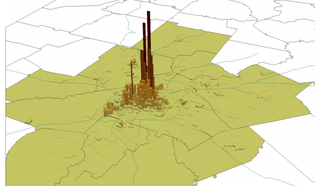
This paper is a 3D Geovisualization of subcounty estimates of historic housing density in the 20-county metro Atlanta Region for 1940–2009 using the Hammer Method. Representing information spatially and temporally, by themselves, are well developed techniques for demographers to use. Representing information spatio-temporally, together, however, is underdeveloped in the demographic literature. This paper includes a number of contemporary geovisualization techniques that can be employed to better visually represent demographic data in a more intuitive manner. Policymakers and other consumers of demographic data could greatly benefit from improved representations of the spatio-temporal data that demographers produce.
Mathew E. Hauer
Associate Professor of Sociology; Head of Agent Developt
My research interests include demography, migration, and climate change.