Housing unit and urbanization estimates for the continental U.S. in consistent tract boundaries, 1940–2019
Abstract
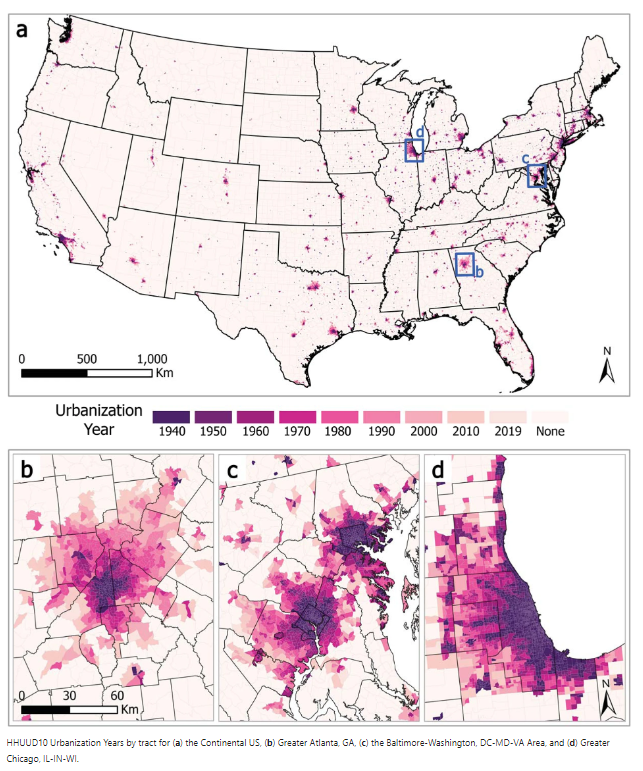
Subcounty housing unit counts are important for studying geo-historical patterns of (sub)urbanization, land-use change, and residential loss and gain. The most commonly used subcounty geographical unit for social research in the United States is the census tract. However, the changing geometries and historically incomplete coverage of tracts present significant obstacles for longitudinal analysis that existing datasets do not sufficiently address. Overcoming these barriers, we provide housing unit estimates in consistent 2010 tract boundaries for every census year from 1940 to 2010 plus 2019 for the entire continental US. Moreover, we develop an “urbanization year” indicator that denotes if and when tracts became “urbanized” during this timeframe. We produce these data by blending existing interpolation techniques with a novel procedure we call “maximum reabsorption.” Conducting out-of-sample validation, we find that our hybrid approach generally produces more reliable estimates than existing alternatives. The final dataset, Historical Housing Unit and Urbanization Database 2010 (HHUUD10), has myriad potential uses for research involving housing, population, and land-use change, as well as (sub)urbanization.